Prairie Sportsman
Northwest Angle Exploring
Clip: Season 16 Episode 4 | 17m 47sVideo has Closed Captions
Host Bret Amundson takes viewers on a tour of the historic Northwest Angle.
Host Bret Amundson takes viewers on a tour of the Northwest Angle. While the area is known for fishing and hunting, visitors can see signs of events that go back hundreds of years. From Fort St Charles to the only one-room schoolhouse in the state. Petroglyphs and pictographs are also highlighted in this tour available from Joe Laurin.
Problems playing video? | Closed Captioning Feedback
Problems playing video? | Closed Captioning Feedback
Prairie Sportsman is a local public television program presented by Pioneer PBS
Production sponsorship is provided by funding from the Environment and Natural Resources Trust Fund and Shalom Hill Farm. Additional funding provided by Big Stone County, Yellow Medicine County, Lac qui...
Support provided by:


Prairie Sportsman
Northwest Angle Exploring
Clip: Season 16 Episode 4 | 17m 47sVideo has Closed Captions
Host Bret Amundson takes viewers on a tour of the Northwest Angle. While the area is known for fishing and hunting, visitors can see signs of events that go back hundreds of years. From Fort St Charles to the only one-room schoolhouse in the state. Petroglyphs and pictographs are also highlighted in this tour available from Joe Laurin.
Problems playing video? | Closed Captioning Feedback
How to Watch Prairie Sportsman
Prairie Sportsman is available to stream on pbs.org and the free PBS App, available on iPhone, Apple TV, Android TV, Android smartphones, Amazon Fire TV, Amazon Fire Tablet, Roku, Samsung Smart TV, and Vizio.
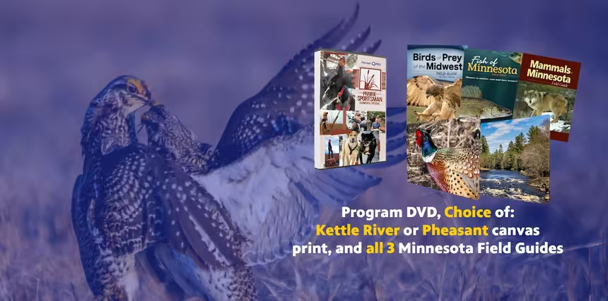
Prairie Sportsman Premium Gifts
To order, email yourtv@pioneer.org or call 1-800-726-3178.Providing Support for PBS.org
Learn Moreabout PBS online sponsorship(dramatic upbeat music) - [Bret] Each summer, thousands of Anglers head to the Northwest Angle in search of walleye, crappies, muskies, and more.
As they launch their boat and motor around Lake of the Woods, they're catching more than fish.
They're navigating routes that have been used for centuries.
(dramatic upbeat music) When you look at a map of the state of Minnesota, you'll notice something at the top that looks a little outta place, almost like a chimney.
Zoom in a little bit, and you'll realize this is the Northwest Angle, a part of the United States surrounded by Canada.
This is called an ex-clave.
And to get there by vehicle, you have to travel through Canada.
You can also travel acros the water of Lake of the Woods and stay in Minnesota the entire time, you can take a boat in the summer, or, in the winter, you can use the Lake of the Woods passenger service, or drive your snowmobile up to 42 miles staked and groomed Grant-In-Aid Trail.
To those that travel to the Angle by vehicle, to get to the islands, you'll have to go through Youngs Bay.
We're up here at the Northwest Angle at the northernmost point in the contiguous United States, Joe Henry.
How long has this buoy been here?
- Boy, I tell you, it's been years now.
But I'll tell you, it's amazing how much attraction it's gotten, Bret.
I mean, you know, we got people coming from all over the world to get a picture with this buoy now.
- [Bret] The Northwest Angle is made up of two parts, the mainland called Angle Inlet.
This area features a number of resorts, but also some of the mos unique landmarks in the state.
- We have the only one-room schoolhouse, you know, in the state of Minnesota.
It's through the Warroad School District, and we have grades K through 6 at that school.
You know, it's funny, I was asking the teacher once about how does that work?
How do you teach the different curriculums?
And she said, "It's so neat because the older kids end up teaching the younger kids.
And by teaching the younger kids, they really inherit the knowledge very thoroughly."
It just kind of a unique way of teaching, and it's just a unique area.
You know, you think about this one.
When those kids get on that bus, they gotta drive hours and hours on that bus every single day.
So I think, as the story goes, they normally sleep on the way to school, they do their homework on the way home.
- [Bret] There's also the northernmost post office on the mainland, and a post office only accessible by boat at Sportsman's Oak Island Lodge.
Those who want a break from being on the water can try their luck at the Northwest Angle Golf Course, which features something you won't see on most golf courses around the world.
- It's really unique.
Seven of the nine greens are actually a hard sand green that you can putt on.
(tranquil upbeat music) Really a cool course, it's beautiful, doesn't cost much to play, and they even have golf carts up here.
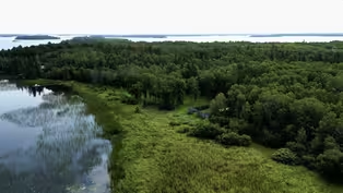
(tranquil upbeat music) - [Bret] The other part of the Angle is made up of water from Lake of the Woods and a handful of islands.
To get there, you'll start at Youngs Bay.
- Seven or eight lodging facilities on on the Angle Inlet here.
Beautiful, it's great for fishing, you got Jerry's Bar and Grill, you got a lot of other resorts.
I mean, it's kind of home base, but anybody that's going in this part of the Northwest Angle, or even this part of Ontario, they come through Youngs Bay right here by the buoy.
- [Bret] There are four resorts at the Angle that offer dining and drinks.
Jerry's on the mainland, and then three on the islands, Sunset Lodge and Sportsman's on Oak Island, and our destination for this trip, Cyrus's Flag Island Resort.
There's a lot of things you can learn about some of the history of the area out in a boat, and that's what we're gonna do tomorrow.
- We're gonna be with Joe Laurin.
And Joe Laurin's a historian from the area, and he actually created an app, the Lake of the Woods Explorer app, and I mean it's got so much, and that's what we're gonna see tomorrow.
- All right, well, tonight, we're going to Flag Island, and we're gonna have some food there.
So, let's jump in a boat.
(intriguing upbeat music) Flag Island Resort has been a popular place to stay for years at the Northwest Angle.
In 2024, it was purchased by Cyrus Resort owners, Justin and Tanya Ferguson.
It's located about three and a half miles from Youngs Bay and features 25 cabins, hotel rooms, and a full-service bar and restaurant.
(intriguing upbeat music) After a big meal and a good night's sleep, we met Joe Laurin at the dock the next morning and headed out on the Lake of the Woods.
All right, so we're on Lake of the Woods at the Northwest Angle right now.
We're not fishing, but we're learning about some of the history.
Joe Laurin is with us from Lighthouse Boat Tours.
What's the first thing we're gonna go see today?
- We're gonna check out a Sunsweep.
And during the solstice whether it be summer or winter, the sun follows the trajectory of this black granite artwork.
And a guy named David Barr in Michigan created these as a peace offering between Canada and the US.
And there's one on Lake of the Woods, there's one in the State of Washington, and one in Maine.
- [Bret] Is this why we'v never gone to war with Canada?
- I think so.
So here you could see it from the lake.
Like, if you look on the left side of the house, you'll see some black granite.
So what happens is, like, about every five years, all the locals come out here, and it's a kind of a big community event, but you could see the black granite stones to the left of the house here.
If the atmosphere conditions are right, the sun will actually glow on the rock and you can see where it's at.
- [Bret] Interesting.
- So they're shaped differently 'cause it follows one rock in the summer, one rock in the winter.
- [Bret] The Sunsweep is located on private land, so you must get permission to view it up close.
It is visible from the lake, however.
(tranquil upbeat music) - Our next stop is Fort St. Charles.
Fort St. Charles is a spot that's equally important to Canadians and Americans, because if you're into exploring, you know, the first explorers, and like the star of the movie, was La Verendrye and Father Aulneau.
And so, if you're in exploring, you got 21 people that came to the island, or came to the lake for the first time, and then you also got a murder mystery.
(suspenseful dramatic music) - [Bret] Is this a park at all?
- Fort St. Charles was actually started by the Crookston Dioceses, and now the Knights of Columbus maintain it.
(suspenseful dramatic music) 1732 is when the fort got its beginning.
21 people stayed in the fort for the first three years.
Pretty cool spot, and you kind of ask yoursel "Why did they pick this spot?"
- Why did they pick it?
- Well, it's kind of unique in a way where it was kind of isolated, you know, like Lake of the Woods in this area, just, you know, having a good harbor is important.
But, you know, even when you look at the layouts here, every building that existed here is kind of laid out by pipes now.
So that was a trading post, Father Aulneau stayed there, that was the chapel.
- [Bret] Yeah.
- [Joe] Pretty unique setup here.
- [Bret] So 1732 to 1749- - Yeah.
Yup, that's kind of when it went.
And then it was kind of forgotten for many years.
For like 200 years, the fort kind of went in a disarray.
And then St. Boniface College in Winnipeg, they actually were doing som history lessons and they said, "You know, we should go try to find that fort."
That's part of that cross in the center.
It says "Fort St. Charles 1732."
Found in 1732, and then refound in 1908.
1908 is kind of like when it's got its beginning again, where they came out here and retraced everything and tried to protect it.
Things were actually well documented then, all the explorers had journals.
So people that came to visit the fort back in the 1732, they could tell you who cam to visit and for what purpose.
It was pretty well-organized for being a primitive time.
- [Bret] This is really neat.
And then the original layout.
So were they able to find a foundation?
- Yup.
- And that's where they put the pipes in?
- Like, even today, when you're going out exploring Lake of the Woods, like the old POW camps, you could see, like, where the buildings were, 'cause they're just humps there, you know, that's kind o what's left of the foundation.
So, even though nature's pretty and it retakes itself, you could still find old building structures.
- And who was it that was here, and then, like, why were they here, and who were they working with, what was their purpose to be here?
- So they came from Quebec, and they kind of came- - [Bret] These were traders?
- [Joe] Yep, traders that came down this way and explorers.
And their goal was to find the Western Sea.
Find the Western Sea, that was a big deal back then.
And, you know, when you come to the Lake of the Woods for the first time, I mean even when you're crossing from Warroad to the Angle, there's like 10 minutes in your where you don't see land, so it's like "Wow, this could be it."
And, you know, you're kind of wondering, "So let's set up camp here and understand this body of water, 'cause it's way bigger than we thought compared to all the other lakes on the way here."
- They had a little bit further to go.
- Right.
(Bret chuckles) Yep, yes, yep.
- So these are French explorers?
- Yep.
- French fur traders.
- Yep.
- They're here, they're starting to work with some of the local natives that are here.
- Yeah.
- And they ended up having a misunderstanding with one of the local tribes.
The French fur traders had an established route that went from Quebec all the way to Lake of the Woods, traveling across Lake Superior through Grand Portage, up the Pigeon River up the Pigeon River across northern Minnesota to Rainy lake, and from there, they'd take the Rainy River to Lake of the Woods and up to the Angle.
They'd established trading partners with some of the local natives.
On June 6th, 1736, 21 of the Fort St. Charles inhabitants were sent on a mission by Jean-Baptiste de La Verendrye for winter supplies.
Father Jean-Pierre Aulneau, the military chaplain at the fort, decided to go with.
Along the way, the group pulled their canoes up on an island to rest for the night.
They built a fire to cook and to stay warm.
It would be the last fire they'd ever make.
A group of natives, angry that the traitors ma have done business with rivals, see the smoke and ambush the French.
All 21 are killed.
- According to the history books, they were buried under cairn of rocks, which just means a pile of rocks.
So that's where they're- - That's Massacre Island.
- Now there's not a lot of dirt up there, so they just had rocks to work with.
- [Bret] And we're going to see that next?
- [Joe] Correct.
(dramatic upbeat music) - Well, it's a beautiful view, even if, you know, a tragic event that took place here.
So behind us up on top of this hill, there's a cross.
- Yeah - So who put that cross there, and why did they put it in that location?
- St. Boniface College, when they were rediscovering the fort in 1908, they came out here 'cause the locals, at that time, said this was where the massacre happened.
So they came out here, there was a pile of rocks, and in the history books, it said the original 21 bodies wer buried under a cairn of rocks.
So you can imagine, you know, just a bunch of pile of rocks.
And then St. Boniface College put the cross up, and they put a little plate down there, 1908, when they were here, to kind of reestablish everything from the fort this way.
So it kind of tells the whole story from Fort St. Charles where everyone lived until the end of their exploring days, when they came here to stay one night, when they're going back for supplies.
- [Bret] After the massacre, the misfortune continued for the 21 who were killed.
- All the headless bodies were buried here.
And then, 1908, St. Boniface College in Winnipeg decided, "You know, we're studying history in this Fort St. Charles place, that's not too far away.
We should do a little field trip and go out and see if we could find that old fort.
No one's talked about it for 200 years.
So St. Boniface College came out here, they could see where the bones were and they said, "You know, we should bring these back to the lab and see if we could find Father Aulneau's and Le Verendrye's, if we understand, you know their bones out of everything.
So they took all the bones out of here, they brought it to Winnipeg, to St. Boniface College.
And within a week, the college building burnt down.
(tranquil upbeat music) So now the bones and the partially burnt bones are in a glass case at St. Boniface College.
Yeah, not to say you guy wanna show that for your show, but I'm just- - It's interesting.
- Like, I tell you the whole thing.
- [Bret] Yeah.
(dramatic upbeat music) - 1929, the stock market crashed and they basically said, "Hey, hell with the world.
Let's live in the middle of the lake with our friends and family and just wait out this depression.
It was 90 to 120 people.
They had some voter rolls, where they actually have a Facebook page, French Portage Narrows, where the ancestors of these families actually are putting together old maps.
They had fresh water supply.
They call it now Root Beer Falls, 'cause inland lake flows into Lake of the Woods, but it's a really dark, stained water.
There's a blueberry patch, sometimes, bears will poke their head over the top.
And this where I've seen wolfs and bears at the same time.
So a lot of people don't realize this is a waterfall, 'cause you almost gotta put your nose at the back rock.
And it's been kind of dry, so I don't think we'll have much water flow.
(water gurgling and murmuring) They had a bunch of old cars there.
One of the cars we'll look at is a 1936 Pontiac, and there's two other cars there.
Carquest does corporate events at one of the Canadian resorts.
One of the cars has Carquest on it, I think that was in their annual report last year.
(lively tranquil music) - So there's a couple of sites like this up here.
These are pictographs here, and then there's petroglyphs, which are carvings.
And how old do you think these pictographs are?
- Hundreds of years old.
I don't know if they actually know technically how old they are, but way before anyone on the lake's lifetime, you know, way before even the explorers were here, you know, before 1700s.
There was this lady, Alicia Colson, from McGill University in Canada she did a study on these, and she said the red was from a part of a sturgeon, 'cause, you know, today's paints don't last that long, and these things are hundreds of years old.
- [Bret] Where are we going next then?
We're gonna go see some petroglyphs.
- So we're gonna go to the Coats Island petroglyphs, where there's actually some interesting carvings there.
Some of it looks like strange letters.
There's like spirals, and there's, like, it eithe could be a canoe or a feather, and like a strange alphabet that has offerings, there's coins, tobacco, clothing.
And, when you see that, it's kind of a special area even to this day.
You know, even when I've gone to Morrison and visited, I got gas there and I'd asked, you know, "What's your most sacred spot?"
They always say the Coats Island petroglyphs.
Probably the uniquest thing that you could just see now is this thing.
It looks like a canoe or a feather.
And then if you look, the water's just, but there's like weird letters there.
(intriguing tranquil music) We're jet skiing around, you know, it looked like a building here.
And then when we jet skied around, we just felt this 50 degree air coming off the island, and we thought, "Wow, that's weird."
And then we crawled up there, and, at first, I thought it was bare den, and we went in there and it's pretty big.
- Tell my mom I love her.
Now this is one of the gold mines up here.
And the opening's kind of narrow, but, once you're in it, I guess it's pretty cool inside, so... And it opens up quite a bit.
So let's go check it out.
Oh yeah.
Quite a bit cooler.
(suspenseful dramatic music) You can see why they came in here.
From what I've learned, the small amount of research I've done, is that quartz veins will indicate the possibility of gold being in here.
And when you come in here, you can see these gold flecks in the rock here.
There's some more back in here.
I mean, I kind of want to grab a pickax and start digging into it.
Like... What was it?
Frosty the snow?
(buzzer buzzing) No, no.
Frosty the snowman?
- No, he said- - You?
- No he called it... - Cornelius?
(buzzer buzzing) - He said, you know, something with "Sam."
(Bret chuckling) - Whatever it is.
But it makes me wanna start mining and get it.
- [Explorer] Oh no, you don't.
- "Get your own Gold!"
- The name's Yukon Cornelius!
The greatest prospector in the North!
Ooh!
(tranquil guitar music) - Well, what a really neat opportunity to come up here to the Northwest Angle and just learn about the history too.
You can come up here to fish, but it's not just fishing up here.
There's a lot of other things that you can do.
And you too can come up here and learn about these things with Joe.
And thank you for taking us out today, I really appreciate it, and if people wanna come up and do this tour, what should they do?
- www.lotw.com, for Lake of the Woods tours.com.
Check it out, and come on up, see some cool stuff.
Check it out, and come on up, see some cool stuff.

Batteries Charged With Renewables
Video has Closed Captions
Clip: S16 Ep4 | 8m 12s | Researchers investigate flow batteries for storing Minnesota’s renewable energy. (8m 12s)
Lighthouse Boats and Storing Renewable Energy
Video has Closed Captions
Preview: S16 Ep4 | 30s | Explore outdoor recreation provided by Minnesota water areas and researchers test flow batteries. (30s)
Providing Support for PBS.org
Learn Moreabout PBS online sponsorship
- Science and Nature

Explore scientific discoveries on television's most acclaimed science documentary series.

- Science and Nature

Capturing the splendor of the natural world, from the African plains to the Antarctic ice.


Support for PBS provided by:
Prairie Sportsman is a local public television program presented by Pioneer PBS
Production sponsorship is provided by funding from the Environment and Natural Resources Trust Fund and Shalom Hill Farm. Additional funding provided by Big Stone County, Yellow Medicine County, Lac qui...